

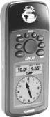
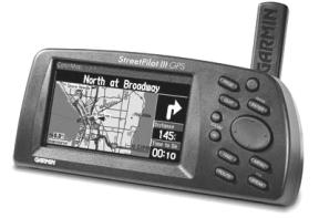
GPS Receiver with Map Standard GPS Receiver
 Control
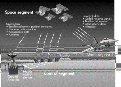
Segment: Each satellite transmits on two microwave frequencies, 1575.42
MHz and 1227.6 MHz. The satellites transmit on the same frequency but the
signals are Doppler shifted. Navigation data is carried on both frequencies.
The control segment is composed of ground-based facilities that control and
monitor the satellites. The master control facility is located at Falcon Air
Force Base in Colorado and five monitor stations and three antennas located
throughout the world.
Control
Segment: Each satellite transmits on two microwave frequencies, 1575.42
MHz and 1227.6 MHz. The satellites transmit on the same frequency but the
signals are Doppler shifted. Navigation data is carried on both frequencies.
The control segment is composed of ground-based facilities that control and
monitor the satellites. The master control facility is located at Falcon Air
Force Base in Colorado and five monitor stations and three antennas located
throughout the world.
How
GPS System works
Monitor stations track all GPS satellites in view and collect ranging information from the satellite broadcasts. This information is then sent back to the master control station, which computes extremely precise satellite orbits.
The
data is then formatted into updated navigation messages for each satellite. The
updated information is transmitted to each satellite via the control up-link
stations, which also transmit and receive satellite control and monitoring
signals.
waypoints and
routes:
A waypoint is just a position stored in the GPS receiver's memory. The receiver can calculate the distance and direction (and time-to-go) to the waypoint, and, if interfaced to an autopilot, will direct the autopilot to steer the boat to the waypoint. A route is a series of waypoints.
When navigating a route, the GPS will automatically change the destination waypoint to the next waypoint on the list as it reaches each waypoint. The GPS receiver normally sounds an alarm, and requires an acknowledgment, before making any course change. Many receivers also have proprietary data formats which are used to transfer waypoint lists, track logs and other data between the GPS and a computer
Differential
GPS:
Differential GPS (DGPS) is a means of correcting for some system errors by using the errors observed at a known location to correct the readings of a roving receiver. The basic concept is that the reference station ‘knows’ its position, and determines the difference between that known position and the position as determined by a GPS receiver. This error measurement is then passed to the roving receiver which can adjust its indicated position to compensate.
The differential reference station computes the errors in the pseudo range measurements for each satellite in view separately, and broadcasts the error information, and other system status information, by some means.
A differential beacon receiver receives and decodes this information, and sends it to the "differential ready" GPS receiver. The GPS receiver combines this information with the individual pseudo range measurements it makes, before calculating the position.
For marine use, the US and Canadian Coast Guards (and corresponding agencies in other countries) have established DGPS reference stations that broadcast the correction data over the existing 250 - 350 KHz marine radio beacons. This marine service is available free of charge in the US and Canada, but, might only be available by subscription in some countries.
Commercial DGPS providers use sub carriers on FM Broadcast stations, and other means, to distribute the correction data.
Advantages of DGPS:
DGPS will eliminate the error introduced by Selective Availability, and errors caused by variations in the ionosphere, resulting in reported positions within about 10 metres (33 ft.) of the true position 95% of the time, for typical marine DGPS systems using inexpensive navigation receivers. Better receivers can get within 3 meters, or so. The DGPS correction data can be used as far as 1500 KM from the reference station depending on the DGPS setup.
GPS
Survey Systems:
For some survey work short range DGPS systems are used. They operate over short distances and achieve accuracies of 0.5 to 1m. In this case, the accuracy is mostly down to the quality of receivers and the short distance between the reciever and base station.
Static
Survey Systems:
Two GPS receivers can be placed in separate locations for a period of time (for short distances 2mins up to 1hr) and the raw pseudo range data can be collected. This data can then be post-processed and a baseline established i.e. range and bearing. This method can then be used to transfer the knowledge of one accurate point, like the GPS antenna on the roof of an office to a new point. This method is regularly used for surveying in new DGPS stations.